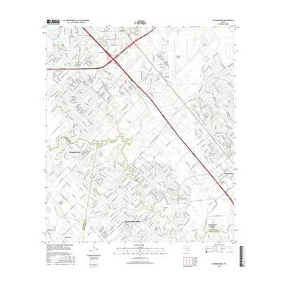
2016 Map of Friendswood
USGS Topo · Published 2016About this map
The coastal prairie landscape south of Houston is defined by a dense network of waterways and modern infrastructure in this mid-2010s survey. Settlements like Friendswood and Pearland are interconnected by major thoroughfares such as the Gulf Fwy and Sam Houston Pkwy, while aviation plays a central role in the region's geography with Ellington Airport and the Pearland Regional Airport anchoring the north and west.
Find a feature on this map
33 named features on this map. Tap any name to fly to it.
Don’t see what you’re looking for? This feature index may not catch every label — zoom into the map to look around manually.
Map Details
Editions of this 2016 Friendswood Map
This is the sole edition of this map. No revisions or reprints were ever made.
Other maps of this area

1915 · Park Place
USGS Topo · 1:24,000

1915 · Deepwater
USGS Topo · 1:24,000

1916 · Genoa
USGS Topo · 1:24,000

1916 · Seabrook
USGS Topo · 1:24,000

1916 · La Porte
USGS Topo · 1:24,000

1919 · Deepwater
USGS Topo · 1:31,680

1920 · Seabrook
USGS Topo · 1:31,680

1920 · Genoa
USGS Topo · 1:31,680

1920 · Mykawa
USGS Topo · 1:31,680

1920 · La Porte
USGS Topo · 1:31,680