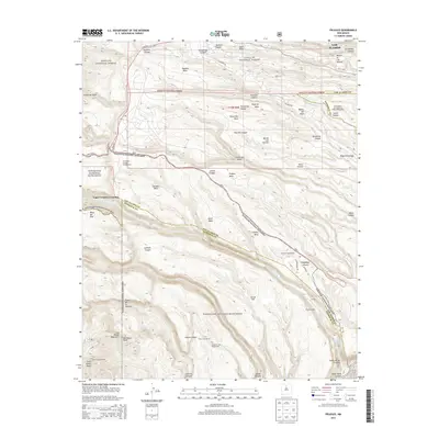
2013 Map of Frijoles
USGS Topo · Published 2013About this map
Los Alamos and the surrounding high mesa country are captured here at a moment of modern transition within the Santa Fe National Forest and Bandelier National Monument. The landscape is defined by its deep volcanic canyons and broad fingers of land, such as Pajarito Mesa and Mesita del Buey, which have shaped both ancient settlement and modern scientific development. The map reveals the location of cultural landmarks like the Pueblo of the Stone Lions and the Stone Lions Shrine near Hondo Canyon, alongside archaeological sites such as Rainbow House. While NM-4 and Pajarito Rd provide modern access, the terrain remains dominated by natural features like the San Miguel Mountains and the dramatic drop into White Rock Canyon. This survey illustrates the intricate relationship between the technical facilities of the laboratory era and the protected wilderness of the Pajarito Plateau.
Find a feature on this map
59 named features on this map. Tap any name to fly to it.
Don’t see what you’re looking for? This feature index may not catch every label — zoom into the map to look around manually.
Map Details
Editions of this 2013 Frijoles Map
This is the sole edition of this map. No revisions or reprints were ever made.
Other maps of this area

1892 · Santa Clara
USGS Topo · 1:125,000

1952 · White Rock
USGS Topo · 1:24,000

1952 · Valle Toledo
USGS Topo · 1:24,000

1952 · Frijoles
USGS Topo · 1:24,000

1952 · Puye
USGS Topo · 1:24,000

1952 · Montoso Peak
USGS Topo · 1:24,000

1952 · Guaje Mountain
USGS Topo · 1:24,000

1953 · Cochiti Dam
USGS Topo · 1:24,000

1953 · Bland
USGS Topo · 1:24,000

1953 · Canada
USGS Topo · 1:24,000