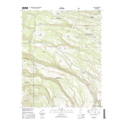
2017 Map of Frijoles
USGS Topo · Published 2017About this map
Manhattan Project National Historical Park and Bandelier National Monument converge in this high-altitude landscape of northern New Mexico, where deep canyons and flat-topped mesas define the topography. The map illustrates the complex intersection of federal land management and history near the southern edges of Los Alamos. Notable archaeological and cultural sites like Tyuonyi and Alcove House are situated along the Rite de los Frijoles, highlighting the ancestral significance of this terrain. The drainage systems are particularly prominent, with the Pajarito, Water, and Capulin canyons carving through the volcanic plateau. Geographic landmarks such as the Stone Lions and Punta de la Ventana sit within the Santa Fe National Forest, while dramatic vertical drops are recorded at Upper Frijoles Falls and Lower Frijoles Falls. Modern infrastructure like Pajarito Rd and various service roads provide access to these remote reaches of the Pajarito Plateau.
Find a feature on this map
69 named features on this map. Tap any name to fly to it.
Don’t see what you’re looking for? This feature index may not catch every label — zoom into the map to look around manually.
Map Details
Editions of this 2017 Frijoles Map
This is the sole edition of this map. No revisions or reprints were ever made.
Other maps of this area

1892 · Santa Clara
USGS Topo · 1:125,000

1952 · White Rock
USGS Topo · 1:24,000

1952 · Valle Toledo
USGS Topo · 1:24,000

1952 · Frijoles
USGS Topo · 1:24,000

1952 · Puye
USGS Topo · 1:24,000

1952 · Montoso Peak
USGS Topo · 1:24,000

1952 · Guaje Mountain
USGS Topo · 1:24,000

1953 · Cochiti Dam
USGS Topo · 1:24,000

1953 · Bland
USGS Topo · 1:24,000

1953 · Canada
USGS Topo · 1:24,000