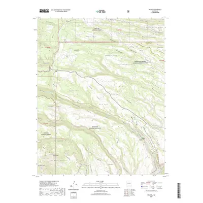
2020 Map of Frijoles
USGS Topo · Published 2020About this map
Bandelier National Monument and the Manhattan Project National Historical Park converge in this high-desert landscape, documenting a profound intersection of ancient history and 20th-century science. The geography is defined by a series of dramatic volcanic plateaus including Pajarito Mesa, Twomile Mesa, and Mesita del Buey, all deeply incised by canyons that drain toward White Rock Canyon. Within these canyon walls lie significant archaeological sites, most notably the Tyuonyi Ruins and the Alcove House along the Rito de los Frijoles. These features, alongside the Stone Lions, provide a detailed look at the ancestral Puebloan footprint in the region. To the north, the scientific legacy of the mid-century era is mapped through infrastructure like Pajarito Rd and the Perimeter road, which cordoned off the secretive laboratory operations. This survey illustrates how the rugged terrain of the Santa Fe National Forest served as both a cultural sanctuary and a strategic stronghold.
Find a feature on this map
70 named features on this map. Tap any name to fly to it.
Don’t see what you’re looking for? This feature index may not catch every label — zoom into the map to look around manually.
Map Details
Editions of this 2020 Frijoles Map
This is the sole edition of this map. No revisions or reprints were ever made.
Other maps of this area

1892 · Santa Clara
USGS Topo · 1:125,000

1952 · White Rock
USGS Topo · 1:24,000

1952 · Valle Toledo
USGS Topo · 1:24,000

1952 · Frijoles
USGS Topo · 1:24,000

1952 · Puye
USGS Topo · 1:24,000

1952 · Montoso Peak
USGS Topo · 1:24,000

1952 · Guaje Mountain
USGS Topo · 1:24,000

1953 · Cochiti Dam
USGS Topo · 1:24,000

1953 · Bland
USGS Topo · 1:24,000

1953 · Canada
USGS Topo · 1:24,000