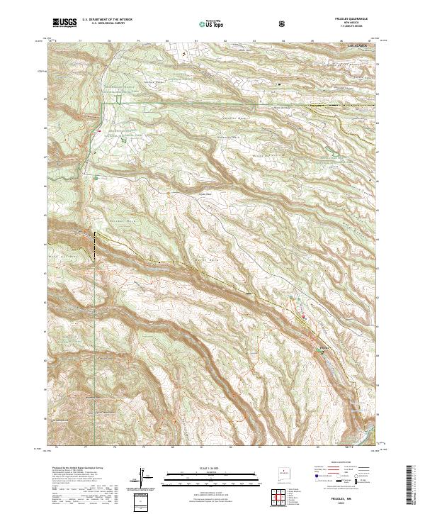
2023 Map of Frijoles
USGS Topo · Published 2023About this map
The Manhattan Project National Historical Park anchors the northern mesas of this landscape, marking the intersection of clandestine mid-century history and the high desert geography of New Mexico. The terrain is defined by a series of dramatic finger mesas, including Pajarito Mesa, Threemile Mesa, and Frijoles Mesa, which are separated by deep drainage systems like Ancho Canyon and Potrillo Canyon. Further south, the map transitions into the protected lands of Bandelier National Monument and the Bandelier Wilderness. Here, the settlement of Frijoles sits near the Rito de los Frijoles, where the water descends toward the Rio Grande via the Upper Frijoles Falls and Lower Frijoles Falls. An extensive network of trails, such as the Frey Trl and Tyuonyi Overlook Trl, provides a detailed record of how this complex topography has been navigated from the era of the ancestral Puebloans through the development of the Los Alamos Laboratory.
Find a feature on this map
74 named features on this map. Tap any name to fly to it.
Don’t see what you’re looking for? This feature index may not catch every label — zoom into the map to look around manually.
Map Details
Editions of this 2023 Frijoles Map
This is the sole edition of this map. No revisions or reprints were ever made.
Other maps of this area

1892 · Santa Clara
USGS Topo · 1:125,000

1952 · White Rock
USGS Topo · 1:24,000

1952 · Valle Toledo
USGS Topo · 1:24,000

1952 · Frijoles
USGS Topo · 1:24,000

1952 · Puye
USGS Topo · 1:24,000

1952 · Montoso Peak
USGS Topo · 1:24,000

1952 · Guaje Mountain
USGS Topo · 1:24,000

1953 · Cochiti Dam
USGS Topo · 1:24,000

1953 · Bland
USGS Topo · 1:24,000

1953 · Canada
USGS Topo · 1:24,000