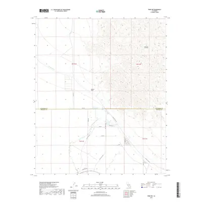
2018 Map of Frink NW
USGS Topo · Published 2018About this map
Hot Mineral Spa serves as the focal point of human activity on this high-desert landscape where the Imperial Valley meets the rising elevations of the Chocolate Mountains. The settlement pattern is defined by its isolation and proximity to vital water infrastructure, notably the Coachella Canal which carves a path through the arid terrain. Regional connectivity is maintained through a network of local thoroughfares including Vaughn Rd, Hot Mineral Spa Rd, and the curiously named Honey Wagon Rd. These routes provide access between the agricultural lowlands and the higher desert reaches near the Riverside and Imperial County line. The map captures the specialized nature of desert living, where geography is dictated by the availability of water at Salt Cr and the specialized recreation or health tourism suggested by the spa's presence.
Find a feature on this map
21 named features on this map. Tap any name to fly to it.
Don’t see what you’re looking for? This feature index may not catch every label — zoom into the map to look around manually.
Map Details
Editions of this 2018 Frink NW Map
This is the sole edition of this map. No revisions or reprints were ever made.
Other maps of this area

1940 · Frink
USGS Topo · 1:62,500

1940 · Cottonwood Spring
USGS Topo · 1:62,500

1940 · Canyon Spring
USGS Topo · 1:62,500

1940 · Durmid
USGS Topo · 1:62,500

1943 · Canyon Spring
USGS Topo · 1:62,500

1944 · Cottonwood Spring
USGS Topo · 1:62,500

1944 · Durmid
USGS Topo · 1:62,500

1944 · Frink
USGS Topo · 1:62,500

1954 · Salton Sea
USGS Topo · 1:250,000

1955 · Salton Sea
USGS Topo · 1:250,000