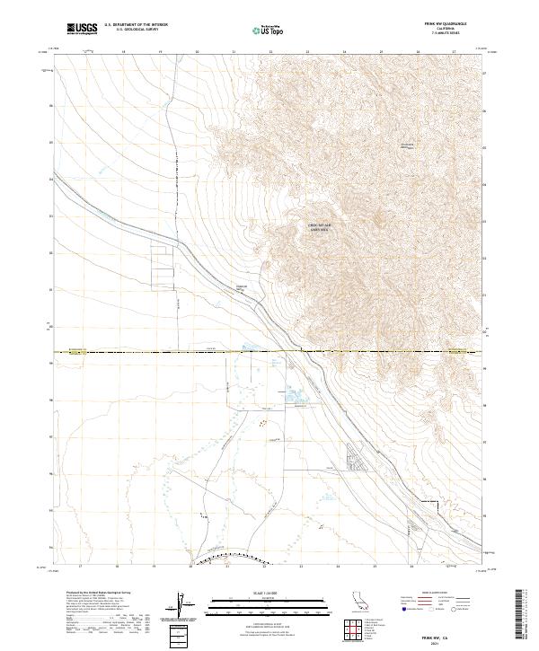
2021 Map of Frink NW
USGS Topo · Published 2021About this map
Hot Mineral Spa serves as a distinct focal point in this desert landscape, situated near the boundary between Riverside and Imperial counties. The terrain transitions from the low-lying Imperial Valley in the west to the rising elevations of the Chocolate Mountains in the northeast. This 2021 survey illustrates a sparse but functional network of desert roads and infrastructure, including the prominent Coachella Canal, which represents a vital water management feature for the region. The map captures a mix of residential and recreational activity along Hot Mineral Spa Rd and Spa Rd, contrasted against the open arid land crossed by Salt Cr. Local landmarks and family-named routes such as Vaughn Rd and Honey Wagon Rd provide specific points of reference for those tracing modern land use and settlement patterns in the California desert.
Find a feature on this map
21 named features on this map. Tap any name to fly to it.
Don’t see what you’re looking for? This feature index may not catch every label — zoom into the map to look around manually.
Map Details
Editions of this 2021 Frink NW Map
This is the sole edition of this map. No revisions or reprints were ever made.
Other maps of this area

1940 · Frink
USGS Topo · 1:62,500

1940 · Cottonwood Spring
USGS Topo · 1:62,500

1940 · Canyon Spring
USGS Topo · 1:62,500

1940 · Durmid
USGS Topo · 1:62,500

1943 · Canyon Spring
USGS Topo · 1:62,500

1944 · Cottonwood Spring
USGS Topo · 1:62,500

1944 · Durmid
USGS Topo · 1:62,500

1944 · Frink
USGS Topo · 1:62,500

1954 · Salton Sea
USGS Topo · 1:250,000

1955 · Salton Sea
USGS Topo · 1:250,000