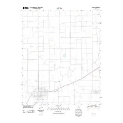
2010 Map of Friona
USGS Topo · Published 2010About this map
Friona serves as the primary hub of this High Plains landscape, organized by a rigid grid of agricultural roads. The town's layout is centered around its residential streets and connections to regional routes like Fm 2298 and Fm 2397. The surrounding terrain is characterized by the episodic water of Black Lake and the drainage of Frio Draw, which meanders across the southern portion of the quadrangle. A notable aviation landmark, the Benger Air Park, sits north of the main settlement, reflecting the region's reliance on aerial activity for crop management and transportation. The map reveals the extensive network of county roads, such as Co Rd A and Co Rd 17, which define the large-scale ranching and farming tracts that have long driven the economy of Parmer County.
Find a feature on this map
26 named features on this map. Tap any name to fly to it.
Don’t see what you’re looking for? This feature index may not catch every label — zoom into the map to look around manually.
Map Details
Editions of this 2010 Friona Map
This is the sole edition of this map. No revisions or reprints were ever made.
Other maps of this area

1954 · Clovis
USGS Topo · 1:250,000

1958 · Clovis
USGS Topo · 1:250,000

1965 · Tam Anne
USGS Topo · 1:24,000

1965 · Parmerton
USGS Topo · 1:24,000

1965 · Hub
USGS Topo · 1:24,000

1965 · Twin Lakes
USGS Topo · 1:24,000

1966 · Friona
USGS Topo · 1:24,000

1966 · Summerfield
USGS Topo · 1:24,000

1970 · Chalk Hill
USGS Topo · 1:24,000

1971 · Westway
USGS Topo · 1:24,000