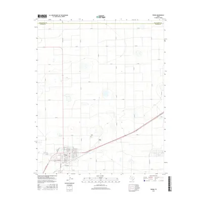
2016 Map of Friona
USGS Topo · Published 2016About this map
Friona serves as the primary hub in this corner of the Texas Panhandle, positioned just south of the Deaf Smith Co - Parmer Co line. The town's grid is well-defined by numerous local streets, including W 15th St and E 14th St, which intersect with the regional road network. The intermittent drainage of Frio Draw cuts through the landscape south of the town center, a reminder of the hydrological patterns common in this high plains environment. Outside the immediate residential and commercial core, Benger Air Park and the Friona Cem stand as distinct landmarks within the agricultural landscape. The surrounding territory is carved into a precise grid of county roads, such as Co Rd A and Co Rd 19, facilitating the transport of goods across the expansive Parmer County plains.
Find a feature on this map
55 named features on this map. Tap any name to fly to it.
Don’t see what you’re looking for? This feature index may not catch every label — zoom into the map to look around manually.
Map Details
Editions of this 2016 Friona Map
This is the sole edition of this map. No revisions or reprints were ever made.
Other maps of this area

1954 · Clovis
USGS Topo · 1:250,000

1958 · Clovis
USGS Topo · 1:250,000

1965 · Tam Anne
USGS Topo · 1:24,000

1965 · Parmerton
USGS Topo · 1:24,000

1965 · Hub
USGS Topo · 1:24,000

1965 · Twin Lakes
USGS Topo · 1:24,000

1966 · Friona
USGS Topo · 1:24,000

1966 · Summerfield
USGS Topo · 1:24,000

1970 · Chalk Hill
USGS Topo · 1:24,000

1971 · Westway
USGS Topo · 1:24,000