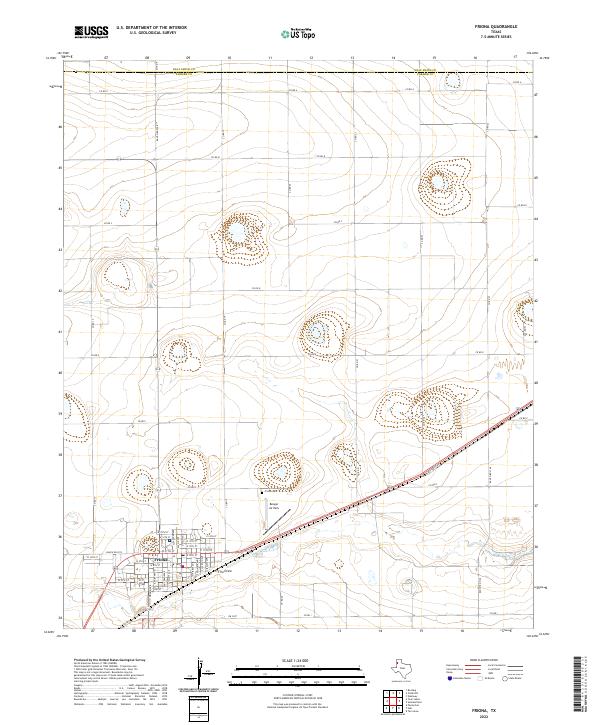
2022 Map of Friona
USGS Topo · Published 2022About this map
Friona serves as the focal point of this Parmer County landscape, positioned along a transportation corridor where the railroad and state highways meet. The town's grid is clearly delineated, stretching from W 15th St down to W 5th St, reflecting the organized growth of this agricultural hub. Just northeast of the main residential area, the Friona Cem and Benger Air Park sit as distinct landmarks on the high plains.
Find a feature on this map
38 named features on this map. Tap any name to fly to it.
Don’t see what you’re looking for? This feature index may not catch every label — zoom into the map to look around manually.
Map Details
Editions of this 2022 Friona Map
This is the sole edition of this map. No revisions or reprints were ever made.
Other maps of this area

1954 · Clovis
USGS Topo · 1:250,000

1958 · Clovis
USGS Topo · 1:250,000

1965 · Tam Anne
USGS Topo · 1:24,000

1965 · Parmerton
USGS Topo · 1:24,000

1965 · Hub
USGS Topo · 1:24,000

1965 · Twin Lakes
USGS Topo · 1:24,000

1966 · Friona
USGS Topo · 1:24,000

1966 · Summerfield
USGS Topo · 1:24,000

1970 · Chalk Hill
USGS Topo · 1:24,000

1971 · Westway
USGS Topo · 1:24,000