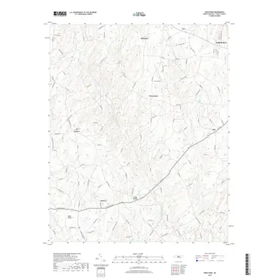
2019 Map of Frog Pond
USGS Topo · Published 2019About this map
Frog Pond and the surrounding Stanly County landscape are defined by a network of rural settlements and winding tributaries. The southern half of the map is dominated by the intersection of local routes near Oakboro and Red Cross, where the terrain begins to level out toward Long Creek. In the north, the terrain becomes more dissected by Big Bear Cr and Ramsey Cr, with small communities like Millingport and Bloomington serving as local anchors.
Find a feature on this map
109 named features on this map. Tap any name to fly to it.
Don’t see what you’re looking for? This feature index may not catch every label — zoom into the map to look around manually.
Map Details
Editions of this 2019 Frog Pond Map
This is the sole edition of this map. No revisions or reprints were ever made.
Other maps of this area

1953 · Charlotte
USGS Topo · 1:250,000

1954 · Charlotte
USGS Topo · 1:250,000

1957 · Mount Pleasant
USGS Topo · 1:62,500

1957 · Albemarle
USGS Topo · 1:62,500

1960 · Charlotte
USGS Topo · 1:250,000

1962 · Charlotte
USGS Topo · 1:250,000
1971 · Stanfield
USGS Topo · 1:24,000
1971 · Oakboro
USGS Topo · 1:24,000
1971 · Aquadale
USGS Topo · 1:24,000
1977 · Albemarle SW
USGS Topo · 1:24,000