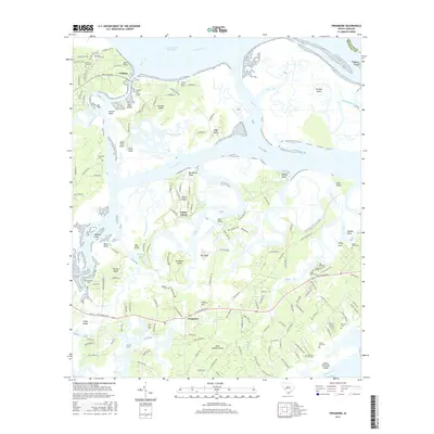
2017 Map of Frogmore
USGS Topo · Published 2017About this map
Saint Helena Island and its surrounding archipelago define this coastal landscape, where the Morgan River and Coosaw River create a complex network of marshes and tidal creeks. The settlement of Frogmore serves as a central point on the island, situated near the Indian Hill area and a cluster of local burial grounds including Piedmont Cem and Cedar Grove Cem. This geographic pattern of small community centers and family cemeteries reflects the long-standing residential history of the Sea Islands.
Find a feature on this map
161 named features on this map. Tap any name to fly to it.
Don’t see what you’re looking for? This feature index may not catch every label — zoom into the map to look around manually.
Map Details
Editions of this 2017 Frogmore Map
This is the sole edition of this map. No revisions or reprints were ever made.
Other maps of this area

1918 · Green Pond
USGS Topo · 1:62,500

1919 · Edisto Island
USGS Topo · 1:62,500

1920 · St. Helena Sound
USGS Topo · 1:62,500

1943 · Edisto Island
USGS Topo · 1:62,500

1943 · Green Pond
USGS Topo · 1:62,500

1944 · Fort Fremont
USGS Topo · 1:62,500

1947 · Savannah
USGS Topo · 1:250,000

1948 · St. Helena Sound
USGS Topo · 1:62,500

1948 · Savannah
USGS Topo · 1:250,000

1956 · Frogmore
USGS Topo · 1:24,000