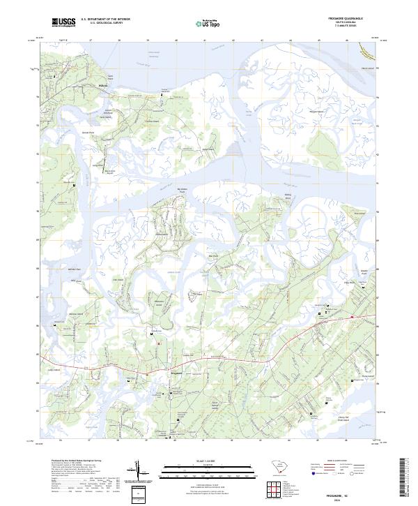
2024 Map of Frogmore
USGS Topo · Published 2024About this map
Reconstruction Era National Monument anchors this 2024 coastal survey, preserving a critical landscape of post-Civil War African American history on Saint Helena Island. The settlement of Frogmore serves as a cultural hub, surrounded by dozens of family and church-affiliated burial grounds that reflect the deep-rooted Gullah Geechee heritage of the Sea Islands. Notable sites include the Brick Baptist Church Cem and the Saint Helenas Chapel of Ease Cem, both central to the area's spiritual and social genealogy.
Find a feature on this map
187 named features on this map. Tap any name to fly to it.
Don’t see what you’re looking for? This feature index may not catch every label — zoom into the map to look around manually.
Map Details
Editions of this 2024 Frogmore Map
This is the sole edition of this map. No revisions or reprints were ever made.
Other maps of this area

1918 · Green Pond
USGS Topo · 1:62,500

1919 · Edisto Island
USGS Topo · 1:62,500

1920 · St. Helena Sound
USGS Topo · 1:62,500

1943 · Edisto Island
USGS Topo · 1:62,500

1943 · Green Pond
USGS Topo · 1:62,500

1944 · Fort Fremont
USGS Topo · 1:62,500

1947 · Savannah
USGS Topo · 1:250,000

1948 · St. Helena Sound
USGS Topo · 1:62,500

1948 · Savannah
USGS Topo · 1:250,000

1956 · Frogmore
USGS Topo · 1:24,000