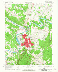
1967 Map of Front Royal
USGS Topo · Published 1968About this map
The Shenandoah River and its two major forks dictate the geography of this northern Virginia region, where the North Fork and South Fork converge near Riverton. The town of Front Royal serves as the focal point, showing an established mid-century grid featuring the Courthouse, Townhall, and the nearby Prospect Hill Cem. Significant industrial footprints are visible at Viscose City and the Industrial Waste Ponds, while the educational landscape is represented by the Randolph Macon Military Academy and Mosby Academy. The map reveals a transition from the developing town center to the northern reaches of Shenandoah National Park and the U.S. Dept of Agriculture Research Center. Rail lines from the Norfolk and Western and Southern railroads connect the quarries and residential pockets of Warren Park and Dungadin Heights to the broader regional economy.
Find a feature on this map
79 named features on this map. Tap any name to fly to it.
Don’t see what you’re looking for? This feature index may not catch every label — zoom into the map to look around manually.
Map Details
Editions of this 1967 Front Royal Map
4 editions found
Other maps of this area

1893 · Luray
USGS Topo · 1:125,000

1894 · Winchester
USGS Topo · 1:125,000

1905 · Luray
USGS Topo · 1:125,000

1923 · Middletown
USGS Topo · 1:62,500

1937 · Middletown
USGS Topo · 1:48,000

1938 · Winchester
USGS Topo · 1:48,000

1939 · Front Royal
USGS Topo · 1:48,000

1942 · Winchester
USGS Topo · 1:62,500

1943 · Middletown
USGS Topo · 1:62,500

1944 · Front Royal
USGS Topo · 1:62,500