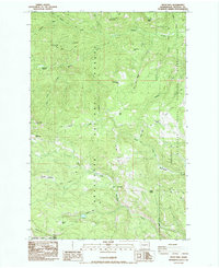
1985 Map of Frost Mtn
USGS Topo · Published 1985About this map
Wenatchee National Forest dominates this high-elevation landscape in the mid-1980s, defined by the prominent Taneum Ridge and the southern Manastash Ridge. This terrain, recorded by the U.S. Geological Survey through aerial photography from 1956 and 1981, reveals a pattern of mountain meadow use and remote water sources. Small enclaves like Cow Camp and named meadows including Frost Meadows and Buck Meadows suggest a history of seasonal grazing and forest management. The eastern edge transition into the L T Murray State Wildlife Recreation Area indicates the evolving priorities of public land use toward wildlife management and recreation during this period. Notable features such as Manastash Lake, Lost Lake, and Tamarack Spring serve as critical hydrological markers in this complex system of ridges and gulches like Willow Gulch.
Find a feature on this map
38 named features on this map. Tap any name to fly to it.
Don’t see what you’re looking for? This feature index may not catch every label — zoom into the map to look around manually.
Map Details
Editions of this 1985 Frost Mtn Map
2 editions found
Other maps of this area

1897 · Mount Stuart
USGS Topo · 1:125,000

1899 · Ellensburg
USGS Topo · 1:125,000

1901 · Ellensburg
USGS Topo · 1:125,000

1901 · Snoqualmie Pass
USGS Topo · 1:125,000

1902 · Mount Aix
USGS Topo · 1:125,000

1902 · Mount Stuart
USGS Topo · 1:125,000

1903 · Snoqualmie
USGS Topo · 1:125,000

1904 · Mt Aix
USGS Topo · 1:125,000

1950 · Yakima
USGS Topo · 1:250,000

1957 · Wenatchee
USGS Topo · 1:250,000