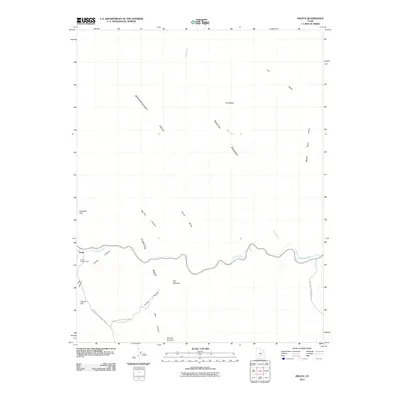
2011 Map of Fruita
USGS Topo · Published 2011About this map
Capitol Reef dominates the landscape in this 2011 survey, showing the intricate geological formations of the Waterpocket Fold and the South Desert. The settlement of Fruita serves as the focal point for access to the Fremont River valley, where the Fruita Campground provides a base for exploring the surrounding canyons. This map illustrates the transition from the high elevations of Horse Mesa and The Notch down into the winding corridors of Spring Canyon and Grand Wash. The road network is sparse, centered on the Capitol Reef National Park Rd and the Notom Bullfrog Basin Rd to the southeast. Notable landmarks like Pectols Pyramid and Danish Hill offer distinct navigational points within the complex canyon systems of Cohab Canyon and Cuts Canyon.
Find a feature on this map
23 named features on this map. Tap any name to fly to it.
Don’t see what you’re looking for? This feature index may not catch every label — zoom into the map to look around manually.
Map Details
Editions of this 2011 Fruita Map
This is the sole edition of this map. No revisions or reprints were ever made.
Other maps of this area

1885 · Fish Lake
USGS Topo · 1:250,000

1896 · Fish Lake
USGS Topo · 1:250,000

1952 · Notom 2 SE
USGS Topo · 1:24,000

1952 · Notom 4 NW
USGS Topo · 1:24,000

1952 · Notom 4 NE
USGS Topo · 1:24,000

1952 · Notom 2 NE
USGS Topo · 1:24,000

1952 · Notom 3 NE
USGS Topo · 1:24,000

1952 · Notom 1 SW
USGS Topo · 1:24,000

1952 · Grover
USGS Topo · 1:62,500

1952 · Torrey
USGS Topo · 1:62,500