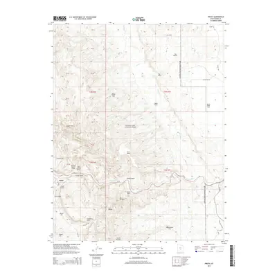
2014 Map of Fruita
USGS Topo · Published 2014About this map
Fruita sits at the heart of this desert landscape, serving as a rare oasis along the Fremont River within the expansive boundaries of Capitol Reef National Park. This 2014 survey documents the dramatic geological features that define Wayne County, including the massive Waterpocket Fold and prominent landmarks like Pectols Pyramid and Danish Hill. The topography is defined by intricate drainage systems such as Deep Cr and Dry Wash, which have carved out notable features like The Narrows and Cohab Canyon.
Find a feature on this map
49 named features on this map. Tap any name to fly to it.
Don’t see what you’re looking for? This feature index may not catch every label — zoom into the map to look around manually.
Map Details
Editions of this 2014 Fruita Map
This is the sole edition of this map. No revisions or reprints were ever made.
Other maps of this area

1885 · Fish Lake
USGS Topo · 1:250,000

1896 · Fish Lake
USGS Topo · 1:250,000

1952 · Notom 2 SE
USGS Topo · 1:24,000

1952 · Notom 4 NW
USGS Topo · 1:24,000

1952 · Notom 4 NE
USGS Topo · 1:24,000

1952 · Notom 2 NE
USGS Topo · 1:24,000

1952 · Notom 3 NE
USGS Topo · 1:24,000

1952 · Notom 1 SW
USGS Topo · 1:24,000

1952 · Grover
USGS Topo · 1:62,500

1952 · Torrey
USGS Topo · 1:62,500