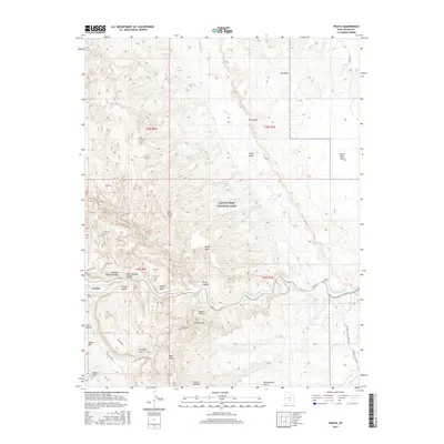
2017 Map of Fruita
USGS Topo · Published 2017About this map
The settlement of Fruita serves as the focal point of this 2017 survey, located where the Fremont River cuts through the high desert geology of Capitol Reef National Park. The map documents a landscape defined by the massive geologic uplift of the Waterpocket Fold, showing the intricate network of canyons and mesas that shaped local travel and habitation. To the east, the Aldrich Cem remains as a tangible connection to the early residents who navigated this complex terrain.
Find a feature on this map
52 named features on this map. Tap any name to fly to it.
Don’t see what you’re looking for? This feature index may not catch every label — zoom into the map to look around manually.
Map Details
Editions of this 2017 Fruita Map
This is the sole edition of this map. No revisions or reprints were ever made.
Other maps of this area

1885 · Fish Lake
USGS Topo · 1:250,000

1896 · Fish Lake
USGS Topo · 1:250,000

1952 · Notom 2 SE
USGS Topo · 1:24,000

1952 · Notom 4 NW
USGS Topo · 1:24,000

1952 · Notom 4 NE
USGS Topo · 1:24,000

1952 · Notom 2 NE
USGS Topo · 1:24,000

1952 · Notom 3 NE
USGS Topo · 1:24,000

1952 · Notom 1 SW
USGS Topo · 1:24,000

1952 · Grover
USGS Topo · 1:62,500

1952 · Torrey
USGS Topo · 1:62,500