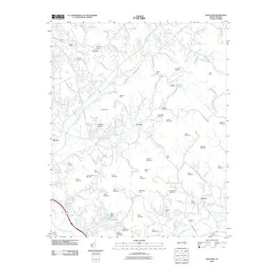
2010 Map of Fruitland
USGS Topo · Published 2010About this map
Fruitland and its surrounding mountain gaps anchor this 2010 topographic study of the Blue Ridge foothills. The landscape is defined by a dense network of peaks and passes, from Rattlesnake Knob and Bald Top Mountain to the narrow corridors of Fairview Gap and Terry Gap. Residential development follows the contours of the land, clustered around historic names like Hoopers Creek and Goodluck, while recreational landmarks such as Camp Judaea and Huckleberry Camp utilize the secluded valley terrain. Genealogists will find significant value in the mapped locations of family-named burial sites, including the Pittillo Lanning Cemetery and Williams Cemetery. Water resources are prominent throughout, including the reservoir at Beech Lake and the winding course of Cane Creek, illustrating how modern drainage and infrastructure integrate with the traditional mountain topography.
Find a feature on this map
131 named features on this map. Tap any name to fly to it.
Don’t see what you’re looking for? This feature index may not catch every label — zoom into the map to look around manually.
Map Details
Editions of this 2010 Fruitland Map
This is the sole edition of this map. No revisions or reprints were ever made.
Other maps of this area

1894 · Asheville
USGS Topo · 1:125,000

1900 · Mount Mitchell
USGS Topo · 1:125,000

1901 · Asheville
USGS Topo · 1:125,000

1902 · Mount Mitchell
USGS Topo · 1:125,000

1905 · Pisgah
USGS Topo · 1:125,000

1906 · Pisgah
USGS Topo · 1:125,000

1907 · Saluda
USGS Topo · 1:125,000

1935 · Horse Shoe
USGS Topo · 1:24,000

1935 · Batcave
USGS Topo · 1:24,000

1935 · Hendersonville
USGS Topo · 1:24,000