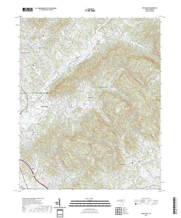
2022 Map of Fruitland
USGS Topo · Published 2022About this map
The rugged topography of the Blue Ridge foothills is meticulously detailed in this 2022 survey, defined by the Buncombe and Henderson county line. The landscape is characterized by prominent peaks and gaps, including Bearwallow Mtn and Rattlesnake Knob, with numerous drainages like Hoopers Creek and Clear Creek carving through the terrain. For family historians and genealogists, the map preserves the locations of several burial grounds, such as the Pittillo Lanning Cem near Fruitland and the Patty's Chapel Cem farther west. Settlement patterns follow the winding creek valleys, with clusters around Fletcher and Goodluck, while aviation history is represented by small local strips like Six Oaks Airport and Cane Creek Airport.
Find a feature on this map
89 named features on this map. Tap any name to fly to it.
Don’t see what you’re looking for? This feature index may not catch every label — zoom into the map to look around manually.
Map Details
Editions of this 2022 Fruitland Map
This is the sole edition of this map. No revisions or reprints were ever made.
Other maps of this area

1894 · Asheville
USGS Topo · 1:125,000

1900 · Mount Mitchell
USGS Topo · 1:125,000

1901 · Asheville
USGS Topo · 1:125,000

1902 · Mount Mitchell
USGS Topo · 1:125,000

1905 · Pisgah
USGS Topo · 1:125,000

1906 · Pisgah
USGS Topo · 1:125,000

1907 · Saluda
USGS Topo · 1:125,000

1935 · Horse Shoe
USGS Topo · 1:24,000

1935 · Batcave
USGS Topo · 1:24,000

1935 · Hendersonville
USGS Topo · 1:24,000