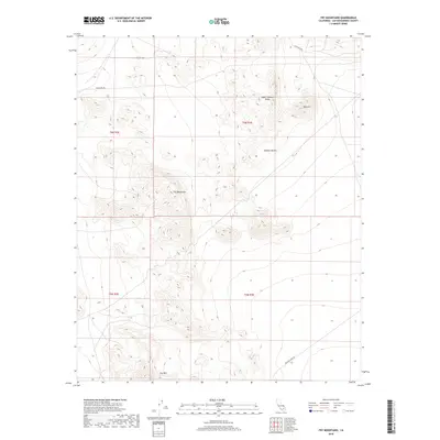
2018 Map of Fry Mountains
USGS Topo · Published 2018About this map
Upper Johnson Valley occupies the northern expanse of this 2018 survey, where the arid floor of the Mojave Desert meets the rising elevations of the Fry Mountains. The landscape is defined by its topographic extremes, ranging from the prominent Red Hill to the southern peak of Fry Mtn. While largely unsettled, the area is traversable via established corridors such as Camp Rock Rd and the utility-oriented Powerline Rd. A notable point of historical interest for mineral seekers is the Bessemer Mine Rd in the southeastern corner, hinting at the region's mining legacy. This topographic study captures the precise township and range boundaries that organize this section of San Bernardino County, illustrating the intersection of natural desert landforms and modern infrastructure.
Find a feature on this map
12 named features on this map. Tap any name to fly to it.
Don’t see what you’re looking for? This feature index may not catch every label — zoom into the map to look around manually.
Map Details
Editions of this 2018 Fry Mountains Map
This is the sole edition of this map. No revisions or reprints were ever made.
Other maps of this area

1901 · Southern California Sheet No. 1
USGS Topo · 1:250,000

1902 · San Gorgonio
USGS Topo · 1:125,000

1904 · Southern California Sheet No. 1
USGS Topo · 1:250,000

1947 · Lucerne Valley
USGS Topo · 1:62,500

1949 · Lucerne Valley
USGS Topo · 1:62,500

1953 · San Bernardino
USGS Topo · 1:250,000

1955 · Silver Bell Mine
USGS Topo · 1:24,000

1955 · Old Woman Springs
USGS Topo · 1:62,500

1955 · Ord Mountains
USGS Topo · 1:62,500

1955 · Rodman Mountains
USGS Topo · 1:62,500