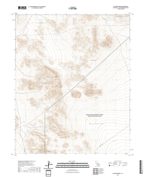
2021 Map of Fry Mountains
USGS Topo · Published 2021About this map
Fry Mountains and the surrounding high desert terrain define this corner of the Mojave Desert in the early 2020s. The landscape is marked by stark geological transitions, from the volcanic-topped Red Hill to the broad expanse of the Upper Johnson Valley. The map details a network of desert access points, including the prominent Camp Rock Rd in the north and Bessemer Mine Rd in the southeast, reflecting the region's history of mineral extraction and utility infrastructure like Powerline Rd. This survey captures the topographical complexity of the southern Rodman Mountains and the eastern fringes of the Ord Mountains, providing a clear look at the drainage patterns and relief that dictate travel and land use in this arid environment.
Find a feature on this map
14 named features on this map. Tap any name to fly to it.
Don’t see what you’re looking for? This feature index may not catch every label — zoom into the map to look around manually.
Map Details
Editions of this 2021 Fry Mountains Map
This is the sole edition of this map. No revisions or reprints were ever made.
Other maps of this area

1901 · Southern California Sheet No. 1
USGS Topo · 1:250,000

1902 · San Gorgonio
USGS Topo · 1:125,000

1904 · Southern California Sheet No. 1
USGS Topo · 1:250,000

1947 · Lucerne Valley
USGS Topo · 1:62,500

1949 · Lucerne Valley
USGS Topo · 1:62,500

1953 · San Bernardino
USGS Topo · 1:250,000

1955 · Silver Bell Mine
USGS Topo · 1:24,000

1955 · Old Woman Springs
USGS Topo · 1:62,500

1955 · Ord Mountains
USGS Topo · 1:62,500

1955 · Rodman Mountains
USGS Topo · 1:62,500