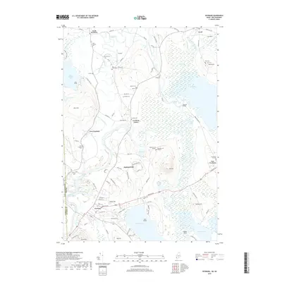
2018 Map of Fryeburg
USGS Topo · Published 2018About this map
Fryeburg and its surrounding hamlets along the Maine and New Hampshire border are defined by the winding hydrology of the Saco River and its abandoned channels. The landscape is a complex network of wetlands and oxbows, most notably the Old Course Saco River, which loops through the center of the quadrangle. This area preserves a high density of small family and community burial grounds, from the North Fryeburg Cem in the north to the Schoolhouse Yard Cem near East Fryeburg. The map reveals how local topography, such as the prominent Jockey Cap and Starks Mtn, guided the development of early settlements like West Fryeburg and Fryeburg Center. Significant landmarks include the Hemlock Bridge and the Toll Bridge Cem, which point to historical river crossings. Between the water bodies like Lovewell Pond and Kezar Pond, the terrain transitions into sandy stretches such as The Plains, reflecting the post-glacial geography of the Saco Valley.
Find a feature on this map
107 named features on this map. Tap any name to fly to it.
Don’t see what you’re looking for? This feature index may not catch every label — zoom into the map to look around manually.
Map Details
Editions of this 2018 Fryeburg Map
This is the sole edition of this map. No revisions or reprints were ever made.
Other maps of this area

1894 · North Conway
USGS Topo · 1:62,500

1896 · North Conway
USGS Topo · 1:62,500

1909 · Fryeburg
USGS Topo · 1:62,500

1910 · Kezar Falls
USGS Topo · 1:48,000

1911 · Fryeburg
USGS Topo · 1:62,500

1911 · Kezar Falls
USGS Topo · 1:62,500

1930 · Ossipee Lake
USGS Topo · 1:62,500

1941 · Fryeburg
USGS Topo · 1:62,500

1942 · North Conway
USGS Topo · 1:62,500

1945 · North Conway
USGS Topo · 1:62,500