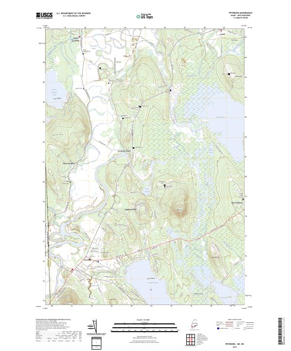
2024 Map of Fryeburg
USGS Topo · Published 2024About this map
The meandering Saco River and its intricate oxbows, including the Old Course Saco River, dominate this modern survey of the Maine and New Hampshire borderlands. The landscape around Fryeburg is defined by these shifting watercourses, where legacy landforms like Horseshoe Pond and Dead Lake trace the river's former paths through the valley. This area preserves a remarkable concentration of local burial grounds, serving as a vital resource for genealogists. From the School House Yard Cem in East Fryeburg to the remote Toll Bridge Cem near Swimming Bog, these sites are scattered across the timbered flats and foothills. Prominent elevations like Jockey Cap and Mt Tom rise above the alluvial plain, providing landmarks that have likely guided travelers since the era of the first river crossings. The layout of satellite settlements such as North Fryeburg, Fryeburg Center, and West Fryeburg illustrates a decentralized historical development pattern tied to the fertile bottomlands of Tib Field and the proximity to Lovewell Pond.
Find a feature on this map
111 named features on this map. Tap any name to fly to it.
Don’t see what you’re looking for? This feature index may not catch every label — zoom into the map to look around manually.
Map Details
Editions of this 2024 Fryeburg Map
This is the sole edition of this map. No revisions or reprints were ever made.
Other maps of this area

1894 · North Conway
USGS Topo · 1:62,500

1896 · North Conway
USGS Topo · 1:62,500

1909 · Fryeburg
USGS Topo · 1:62,500

1910 · Kezar Falls
USGS Topo · 1:48,000

1911 · Fryeburg
USGS Topo · 1:62,500

1911 · Kezar Falls
USGS Topo · 1:62,500

1930 · Ossipee Lake
USGS Topo · 1:62,500

1941 · Fryeburg
USGS Topo · 1:62,500

1942 · North Conway
USGS Topo · 1:62,500

1945 · North Conway
USGS Topo · 1:62,500