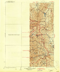
1928 Map of Ft. Douglas
USGS Topo · Published 1943About this map
Park City stands as a central industrial and social hub in this high-altitude survey, reflecting the region's early 20th-century dependence on mining and transit. The Pacific Mine and the presence of the Denver and Rio Grande Western RR underscore the extractive economy that shaped these canyons. Higher in the terrain, recreational and institutional footprints appear at the YWCA Camp and Pinecrest Inn, suggesting a shift toward seasonal residency and mountain escapes even as traditional agriculture persists at the City Farm.
Find a feature on this map
94 named features on this map. Tap any name to fly to it.
Don’t see what you’re looking for? This feature index may not catch every label — zoom into the map to look around manually.
Map Details
Editions of this 1928 Ft. Douglas Map
2 editions found
Other maps of this area

1885 · Salt Lake
USGS Topo · 1:250,000

1885 · Tooele Valley
USGS Topo · 1:250,000

1900 · Coalville
USGS Topo · 1:125,000

1903 · Coalville
USGS Topo · 1:125,000

1907 · Strawberry Valley
USGS Topo · 1:125,000

1909 · Strawberry Valley
USGS Topo · 1:125,000

1915 · Fairfield
USGS Topo · 1:62,500

1917 · Fairfield
USGS Topo · 1:62,500

1925 · Ft. Douglas
USGS Topo · 1:125,000

1928 · Ft. Douglas
USGS Topo · 1:125,000