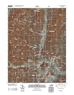
2011 Map of Fulks Run
USGS Topo · Published 2011About this map
Yankeetown and Genoa anchor this pocket of Rockingham County, where the North Fork Shenandoah River snakes through the valley floor. The landscape is defined by its water systems, from the course of Little Dry River to the Shoemaker River and the structural presence of Claycomb Dam. The terrain rises sharply toward Church Mountain and Buffalo Clover Knob, with much of the higher ground preserved within the Washington National Forest. Local history is rooted in the small settlements and family-named landmarks like Trumbo Cemetery, while the network of mountain roads such as Lairs Run Rd and Turner Run Rd follows the natural drainages of Lairs Run and Turner Run. This 2011 survey captures the area's enduring rural character and the complex hydrology of the Shenandoah watershed.
Find a feature on this map
66 named features on this map. Tap any name to fly to it.
Don’t see what you’re looking for? This feature index may not catch every label — zoom into the map to look around manually.
Map Details
Editions of this 2011 Fulks Run Map
This is the sole edition of this map. No revisions or reprints were ever made.
Other maps of this area

1892 · Franklin
USGS Topo · 1:125,000

1892 · Woodstock
USGS Topo · 1:125,000

1896 · Franklin
USGS Topo · 1:125,000

1920 · Petersburg
USGS Topo · 1:48,000

1921 · Orkney Springs
USGS Topo · 1:48,000

1921 · Petersburg
USGS Topo · 1:48,000

1922 · Fort Seybert
USGS Topo · 1:48,000

1922 · Petersburg
USGS Topo · 1:62,500

1923 · Orkney Springs
USGS Topo · 1:62,500

1924 · Fort Seybert
USGS Topo · 1:62,500