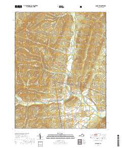
2019 Map of Fulks Run
USGS Topo · Published 2019About this map
The North Fork Shenandoah River carves a deep valley through the eastern portion of this map, joined by the Shoemaker River near the small settlement of Fulks Run. This drainage system defines the local geography, separating the high peaks of Church Mtn and Little Mtn from the broader western uplands. The terrain is marked by numerous family-named landmarks and geographic features such as Buffalo Clover Knob and Wetzel Knob, illustrating the long-standing local ties to the land.
Find a feature on this map
78 named features on this map. Tap any name to fly to it.
Don’t see what you’re looking for? This feature index may not catch every label — zoom into the map to look around manually.
Map Details
Editions of this 2019 Fulks Run Map
This is the sole edition of this map. No revisions or reprints were ever made.
Other maps of this area

1892 · Franklin
USGS Topo · 1:125,000

1892 · Woodstock
USGS Topo · 1:125,000

1896 · Franklin
USGS Topo · 1:125,000

1920 · Petersburg
USGS Topo · 1:48,000

1921 · Orkney Springs
USGS Topo · 1:48,000

1921 · Petersburg
USGS Topo · 1:48,000

1922 · Fort Seybert
USGS Topo · 1:48,000

1922 · Petersburg
USGS Topo · 1:62,500

1923 · Orkney Springs
USGS Topo · 1:62,500

1924 · Fort Seybert
USGS Topo · 1:62,500