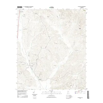
2014 Map of Fulton East
USGS Topo · Published 2014About this map
Fulton and Thomasville anchor the western edge of this 2014 survey of Clarke County, where the industrial corridors of S Industrial Park Dr and N Clarke Industrial Rd meet the older routes of Old Highway 5 S. The landscape is defined by the winding paths of Bassett Creek and Little Bassett Creek, which drain a region of dense woodlots and small family settlements. Rural genealogists will find several burial grounds mapped, including Tate Cemetery and Henley Cemetery, alongside smaller communities like Dickinson and Rural. The transition from the town grid of Fulton to the outlying areas of Scyrene and McWer illustrates the enduring rural-industrial character of south Alabama, where modern developments like Reservoir Rd exist alongside historic landmarks like Salem Cemetery.
Find a feature on this map
60 named features on this map. Tap any name to fly to it.
Don’t see what you’re looking for? This feature index may not catch every label — zoom into the map to look around manually.
Map Details
Editions of this 2014 Fulton East Map
This is the sole edition of this map. No revisions or reprints were ever made.
Other maps of this area

1953 · Andalusia
USGS Topo · 1:250,000

1957 · Andalusia
USGS Topo · 1:250,000

1972 · Whatley
USGS Topo · 1:24,000

1972 · Chance
USGS Topo · 1:24,000

1973 · Fulton East
USGS Topo · 1:24,000

1973 · Pine Hill
USGS Topo · 1:24,000

1973 · Thomasville
USGS Topo · 1:24,000

1973 · Lower Peach Tree
USGS Topo · 1:24,000
1978 · Bashi
USGS Topo · 1:24,000
1978 · Grove Hill
USGS Topo · 1:24,000