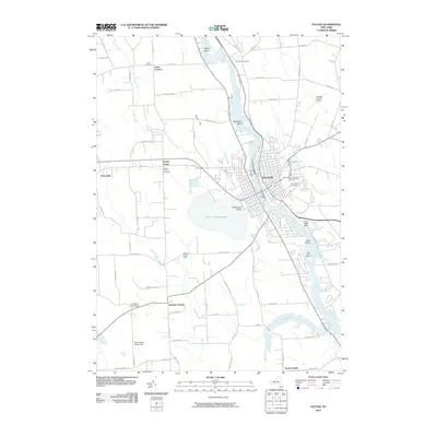
2010 Map of Fulton
USGS Topo · Published 2010About this map
The Oswego River and the parallel Canal define the industrial and transit corridor of this Central New York landscape, anchoring the city of Fulton. This corridor is punctuated by several significant islands, including Battle Island and Pathfinder Island, which have historically served as landmarks for navigation and local industry. To the west, the expansive Lake Neatahwanta provides a natural counterpoint to the urban grid, with Stevenson Beach marking its eastern shore.
Find a feature on this map
74 named features on this map. Tap any name to fly to it.
Don’t see what you’re looking for? This feature index may not catch every label — zoom into the map to look around manually.
Map Details
Editions of this 2010 Fulton Map
This is the sole edition of this map. No revisions or reprints were ever made.
Other maps of this area

1900 · Baldwinsville
USGS Topo · 1:62,500

1900 · Oswego
USGS Topo · 1:62,500

1900 · Fulton
USGS Topo · 1:62,500

1902 · Weedsport
USGS Topo · 1:62,500

1943 · Oswego East
USGS Topo · 1:31,680

1943 · Lysander
USGS Topo · 1:31,680

1943 · New Haven
USGS Topo · 1:31,680

1943 · Oswego West
USGS Topo · 1:31,680

1943 · Cato
USGS Topo · 1:31,680

1943 · Pennellville
USGS Topo · 1:31,680