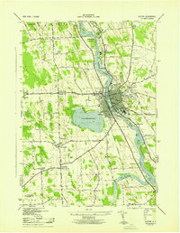
1943 Map of Fulton
USGS Topo · Published 1943About this map
The Oswego River serves as the industrial and geographic spine of this 1943 survey, flowing through the heart of Fulton. The city is a hub of transportation and civic life, featuring City Hall, the Public Library, and the Fulton Municipal Airport. This era shows a dense network of railroads including the New York Central Railroad and the Delaware Lackawanna and Western Railroad, which intersect the river's path and support the local Water Works.
Find a feature on this map
69 named features on this map. Tap any name to fly to it.
Don’t see what you’re looking for? This feature index may not catch every label — zoom into the map to look around manually.
Map Details
Editions of this 1943 Fulton Map
This is the sole edition of this map. No revisions or reprints were ever made.
Other maps of this area

1900 · Baldwinsville
USGS Topo · 1:62,500

1900 · Oswego
USGS Topo · 1:62,500

1900 · Fulton
USGS Topo · 1:62,500

1902 · Weedsport
USGS Topo · 1:62,500

1943 · Oswego East
USGS Topo · 1:31,680

1943 · Lysander
USGS Topo · 1:31,680

1943 · New Haven
USGS Topo · 1:31,680

1943 · Oswego West
USGS Topo · 1:31,680

1943 · Cato
USGS Topo · 1:31,680

1943 · Pennellville
USGS Topo · 1:31,680