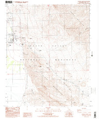
1988 Map of Furnace Creek
USGS Topo · Published 1988About this map
Harmony Borax Works (Ruins) serves as a reminder of the industrial activity that once shaped this portion of the Death Valley National Monument during the late nineteenth century. By the 1980s, the area had transitioned into a center for desert tourism and administration, centered around the Furnace Creek Ranch and the nearby Visitor Center. The map reveals a cluster of developed sites including the Furnace Creek Campground, Sunset Campground, and Texas Springs Campground, alongside an Indian Village and a Cem. The landscape is dominated by the steep rises of the Funeral Mountains and Black Mountains, which flank the valley floor. Geological and historical landmarks such as Zabriskie Point, Manly Beacon, and Mushroom Rock are clearly marked, while the legendary Twenty Mule Team Canyon and various Prospect locations trace the paths of early miners and transporters who navigated this arid environment.
Find a feature on this map
35 named features on this map. Tap any name to fly to it.
Don’t see what you’re looking for? This feature index may not catch every label — zoom into the map to look around manually.
Map Details
Editions of this 1988 Furnace Creek Map
2 editions found
Other maps of this area

1908 · Furnace Creek
USGS Topo · 1:250,000

1910 · Furnace Creek
USGS Topo · 1:250,000

1942 · Bullfrog
USGS Topo · 1:125,000

1948 · Death Valley
USGS Topo · 1:250,000

1952 · Chloride Cliff
USGS Topo · 1:50,000

1952 · Furnace Creek
USGS Topo · 1:62,500

1952 · Ryan
USGS Topo · 1:62,500

1952 · Big Dune
USGS Topo · 1:62,500

1954 · Death Valley
USGS Topo · 1:250,000

1956 · Death Valley
USGS Topo · 1:250,000