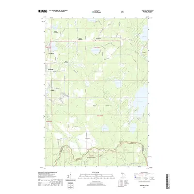
2019 Map of Gaastra
USGS Topo · Published 2019About this map
The Brule River forms a jagged natural boundary between Michigan and Wisconsin along the southern edge of this Iron County landscape. This region is defined by its deep mining and timber heritage, reflected in the cluster of worker settlements like Bates Location, Rogers Location, and Palatka that surround the larger hubs of Iron River and Stambaugh. The industrial footprint is evident in the network of specialized routes such as Chicagon Mine Rd, which lead away from the residential centers toward the resources of the surrounding forest.
Find a feature on this map
98 named features on this map. Tap any name to fly to it.
Don’t see what you’re looking for? This feature index may not catch every label — zoom into the map to look around manually.
Map Details
Editions of this 2019 Gaastra Map
This is the sole edition of this map. No revisions or reprints were ever made.
Other maps of this area

1898 · Iron River
USGS Topo · 1:62,500

1899 · Crystal Falls
USGS Topo · 1:62,500

1939 · Long Lake
USGS Topo · 1:48,000

1941 · Florence
USGS Topo · 1:48,000

1944 · Iron River
USGS Topo · 1:24,000

1944 · Gaastra
USGS Topo · 1:24,000

1944 · Fortune Lakes
USGS Topo · 1:24,000

1945 · Gibbs City
USGS Topo · 1:24,000

1945 · Sunset Lake
USGS Topo · 1:24,000

1945 · Amasa
USGS Topo · 1:24,000