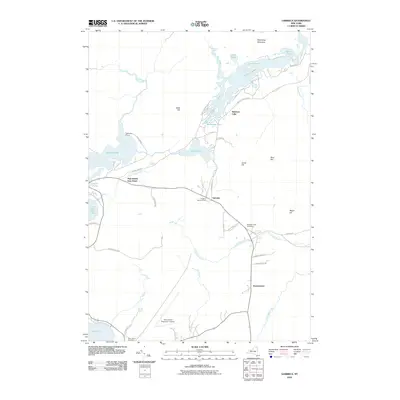
2010 Map of Gabriels
USGS Topo · Published 2010About this map
White Pine Camp and the small settlements of Paul Smiths and Gabriels anchor this landscape in the northern Adirondacks. The area is defined by an intricate network of waterways, including Rainbow Lake, Osgood Pond, and Jones Pond, which historically supported the region's transition from a logging economy to a famed wilderness retreat. Large portions of the quadrangle fall within the Adirondack Park, where the terrain rises toward heights such as Meenahga Mountain and Blue Hill.
Find a feature on this map
45 named features on this map. Tap any name to fly to it.
Don’t see what you’re looking for? This feature index may not catch every label — zoom into the map to look around manually.
Map Details
Editions of this 2010 Gabriels Map
This is the sole edition of this map. No revisions or reprints were ever made.
Other maps of this area

1902 · Saranac
USGS Topo · 1:62,500

1904 · Saranac
USGS Topo · 1:62,500

1905 · Saint Regis
USGS Topo · 1:62,500

1906 · Loon Lake
USGS Topo · 1:62,500

1908 · Loon Lake
USGS Topo · 1:62,500

1921 · Santa Clara
USGS Topo · 1:62,500

1923 · Santa Clara
USGS Topo · 1:62,500

1948 · Ogdensburg
USGS Topo · 1:250,000

1951 · Ogdensburg
USGS Topo · 1:250,000

1953 · Ogdensburg
USGS Topo · 1:250,000