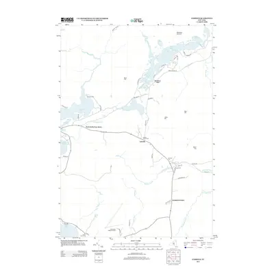
2013 Map of Gabriels
USGS Topo · Published 2013About this map
Rainbow Lake and its intricate network of inlets and peninsulas dominate the northern reach of this landscape, reflecting a region defined by water and forest. The settlement of Gabriels sits at a central crossroads near Brighton Memorial Park, while the historic White Pine Camp remains situated along the shores of Osgood Pond. This survey captures the rural layout of Harrietstown during the early 21st century, showing the spatial relationship between local landmarks like Mtn View Cem and the larger Adirondack Regional Airport. The geography is shaped by the winding Saint Regis River and Osgood River, which connect numerous bodies of water such as Jones Pond and Lower Saint Regis Lake. Transportation is facilitated by a grid of local routes including Gabriels-Onchiota Rd and Wardner Rd, providing access to the area's hills and brooks.
Find a feature on this map
61 named features on this map. Tap any name to fly to it.
Don’t see what you’re looking for? This feature index may not catch every label — zoom into the map to look around manually.
Map Details
Editions of this 2013 Gabriels Map
This is the sole edition of this map. No revisions or reprints were ever made.
Other maps of this area

1902 · Saranac
USGS Topo · 1:62,500

1904 · Saranac
USGS Topo · 1:62,500

1905 · Saint Regis
USGS Topo · 1:62,500

1906 · Loon Lake
USGS Topo · 1:62,500

1908 · Loon Lake
USGS Topo · 1:62,500

1921 · Santa Clara
USGS Topo · 1:62,500

1923 · Santa Clara
USGS Topo · 1:62,500

1948 · Ogdensburg
USGS Topo · 1:250,000

1951 · Ogdensburg
USGS Topo · 1:250,000

1953 · Ogdensburg
USGS Topo · 1:250,000