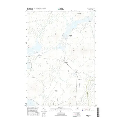
2016 Map of Gabriels
USGS Topo · Published 2016About this map
Paul Smiths and the hamlet of Gabriels anchor this 2016 survey of the northern Adirondack landscape, where water and wood define the local economy and culture. The map documents a complex aquatic network including Rainbow Lake, Osgood Pond, and Loon Lake, linked by the Osgood River and numerous smaller brooks. This area is characterized by significant topographical features such as Buck Hill and Jones Hill, while the southern portion of the sheet is dominated by the Adirondack Regional Airport near Harrietstown. Local history is preserved through sites like Saint Johns Cem and Mountain View Cem, situated alongside transit routes like Co Rd 60 and the Adirondack Park corridor. The geography reveals the intersection of wilderness preservation and modern infrastructure within the Adirondack Park Preserve.
Find a feature on this map
59 named features on this map. Tap any name to fly to it.
Don’t see what you’re looking for? This feature index may not catch every label — zoom into the map to look around manually.
Map Details
Editions of this 2016 Gabriels Map
This is the sole edition of this map. No revisions or reprints were ever made.
Other maps of this area

1902 · Saranac
USGS Topo · 1:62,500

1904 · Saranac
USGS Topo · 1:62,500

1905 · Saint Regis
USGS Topo · 1:62,500

1906 · Loon Lake
USGS Topo · 1:62,500

1908 · Loon Lake
USGS Topo · 1:62,500

1921 · Santa Clara
USGS Topo · 1:62,500

1923 · Santa Clara
USGS Topo · 1:62,500

1948 · Ogdensburg
USGS Topo · 1:250,000

1951 · Ogdensburg
USGS Topo · 1:250,000

1953 · Ogdensburg
USGS Topo · 1:250,000