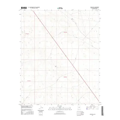
2017 Map of Gacho Hill
USGS Topo · Published 2017About this map
Joffre sits in the high desert plains of Guadalupe County, anchored by the long diagonal of US Route 285 as it cuts northwest to southeast across the terrain. This landscape is defined by wide-open ranching country and the prominent elevation of Gacho Hill, which serves as a central landmark for the surrounding townships. The road network reflects a quiet rural infrastructure, where named routes like Rica Rd and Jackalope Rd diverge from the main highway to serve isolated homesteads and grazing lands. Surveyed late in the twentieth century, the map details the precise township and range divisions, including t3n r18e and t2n r18e, illustrating how public land systems continue to organize the New Mexico high country.
Find a feature on this map
13 named features on this map. Tap any name to fly to it.
Don’t see what you’re looking for? This feature index may not catch every label — zoom into the map to look around manually.
Map Details
Editions of this 2017 Gacho Hill Map
This is the sole edition of this map. No revisions or reprints were ever made.
Other maps of this area

1954 · Fort Sumner
USGS Topo · 1:250,000

1958 · Fort Sumner
USGS Topo · 1:250,000

1978 · Vaughn
USGS Topo · 1:24,000

1978 · El Morro Ranch
USGS Topo · 1:24,000

1978 · Long Draw
USGS Topo · 1:24,000

1979 · Fort Sumner
USGS Topo · 1:100,000

1980 · Corona
USGS Topo · 1:100,000

1981 · Loco Draw
USGS Topo · 1:24,000

1981 · Gacho Hill NW
USGS Topo · 1:24,000

1981 · Gacho Hill SW
USGS Topo · 1:24,000