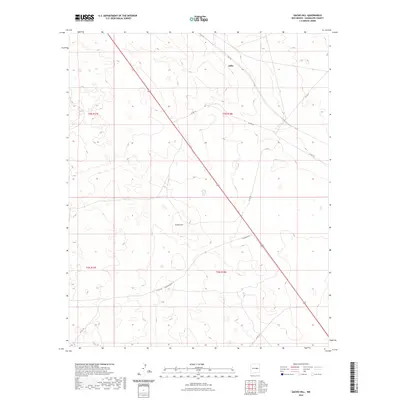
2023 Map of Gacho Hill
USGS Topo · Published 2023About this map
Joffre stands as the primary named settlement in this high-plains landscape, situated along the diagonal corridor of US Route 285 in Guadalupe County. This modern survey reflects the persistent sparse population of the region, where the terrain is dominated by the namesake Gacho Hill and a network of county roads that crisscross the arid environment. A distinct grid of township and range lines, including t3n r17e and t2n r18e, defines the land divisions, while named thoroughfares like Rica Rd and the whimsically named Jackalope Rd provide the only significant markers of human activity. The map reveals a land of wide-open spaces and large-scale ranching plots, where small livestock ponds or tanks serve as vital water sources for the cattle industry that has long sustained this part of New Mexico.
Find a feature on this map
12 named features on this map. Tap any name to fly to it.
Don’t see what you’re looking for? This feature index may not catch every label — zoom into the map to look around manually.
Map Details
Editions of this 2023 Gacho Hill Map
This is the sole edition of this map. No revisions or reprints were ever made.
Other maps of this area

1954 · Fort Sumner
USGS Topo · 1:250,000

1958 · Fort Sumner
USGS Topo · 1:250,000

1978 · Vaughn
USGS Topo · 1:24,000

1978 · El Morro Ranch
USGS Topo · 1:24,000

1978 · Long Draw
USGS Topo · 1:24,000

1979 · Fort Sumner
USGS Topo · 1:100,000

1980 · Corona
USGS Topo · 1:100,000

1981 · Loco Draw
USGS Topo · 1:24,000

1981 · Gacho Hill NW
USGS Topo · 1:24,000

1981 · Gacho Hill SW
USGS Topo · 1:24,000