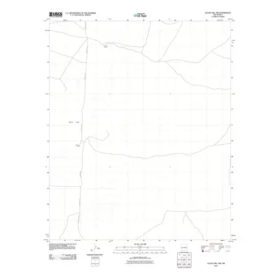
2010 Map of Gacho Hill NW
USGS Topo · Published 2010About this map
Vicente Ranch and Del Curto Ranch anchor this high plains landscape in eastern New Mexico, representing the enduring ranching tradition of Guadalupe County. The terrain is defined by wide drainage patterns, most notably Marino Draw, which cuts across the western portion of the quadrangle. This 2010 survey illustrates the remote infrastructure of the region, where a network of local routes including County Rd-3K, County Rd-3KA, and County Rd-3A provides the primary access between isolated homesteads and grazing lands. The map detail highlights how modern digital surveying techniques are applied to sparsely populated western rangelands, capturing the subtle intersections of fence lines and ranch access roads in a territory where water sources like the draw are central to land use and navigation.
Find a feature on this map
6 named features on this map. Tap any name to fly to it.
Don’t see what you’re looking for? This feature index may not catch every label — zoom into the map to look around manually.
Map Details
Editions of this 2010 Gacho Hill NW Map
This is the sole edition of this map. No revisions or reprints were ever made.
Other maps of this area

1954 · Fort Sumner
USGS Topo · 1:250,000

1958 · Fort Sumner
USGS Topo · 1:250,000

1978 · Vaughn
USGS Topo · 1:24,000

1978 · Tejon
USGS Topo · 1:24,000

1978 · Long Draw
USGS Topo · 1:24,000

1980 · Corona
USGS Topo · 1:100,000

1981 · Gacho Hill NW
USGS Topo · 1:24,000

1981 · Gacho Hill SW
USGS Topo · 1:24,000

1981 · Camaleon Draw East
USGS Topo · 1:24,000

1981 · Gacho Hill SE
USGS Topo · 1:24,000