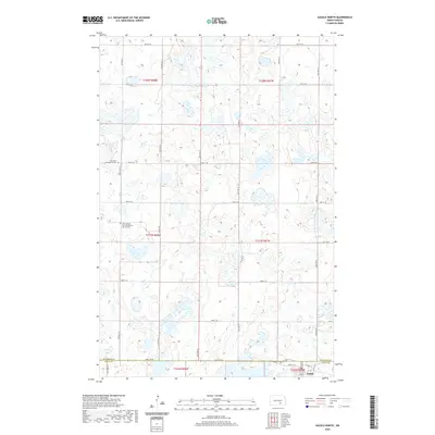
2020 Map of Gackle North
USGS Topo · Published 2020About this map
The Stutsman Co Logan Co boundary line runs through this prairie landscape, where the town of Gackle anchors the southeastern corner. This area of the North Dakota plains is characterized by a dense network of small wetlands and depressions that dot the terrain, influencing the grid of section lines and gravel roads. Local history and genealogy interests are centered on the rural religious sites that served early settlers, including the Bloomenfeld German Baptist Church Cem and the Germania Evangelical Cem. These sites, along with names like Neu Dorf Rd, reflect the ethnic heritage of the German-Russian communities that populated the region. The map captures the interplay between the strictly surveyed township lines, such as t137n r68w, and the scattered water bodies that break the agricultural pattern.
Find a feature on this map
32 named features on this map. Tap any name to fly to it.
Don’t see what you’re looking for? This feature index may not catch every label — zoom into the map to look around manually.
Map Details
Editions of this 2020 Gackle North Map
This is the sole edition of this map. No revisions or reprints were ever made.
Other maps of this area

1953 · Jamestown
USGS Topo · 1:250,000

1953 · Cleveland SE
USGS Topo · 1:24,000

1953 · Cleveland SW
USGS Topo · 1:24,000

1955 · Medina SE
USGS Topo · 1:24,000

1956 · Jamestown
USGS Topo · 1:250,000

1983 · Alfred
USGS Topo · 1:24,000

1983 · Streeter
USGS Topo · 1:24,000

1983 · Gackle North
USGS Topo · 1:24,000

1983 · Streeter SE
USGS Topo · 1:24,000
1983 · Gackle South
USGS Topo · 1:24,000