
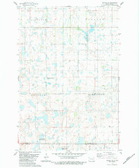
1953 Map of Cleveland SW
USGS Topo · Published 1955About this map
Glacial depressions and marshy basins define this prairie landscape in Stutsman County, where numerous sloughs punctuate the agricultural sections. The map reveals a rural structure organized around local community hubs, such as the Community Hall in the eastern reaches and the Friedens Cem in the southwest. The presence of School No 1 and School No 4 near School Lake illustrates the distributed educational system of the mid-20th century before school consolidation reshaped the rural Midwest. These features, along with the distinct boundaries of Bloomenfield and Sinclair, provide a detailed look at the human footprint on the land. The topography is dominated by natural drainage features like Trautman Slough, Runner Slough, and Balch Slough, showing the complex hydrology of the region prior to extensive modern alterations.
Find a feature on this map
16 named features on this map. Tap any name to fly to it.
Don’t see what you’re looking for? This feature index may not catch every label — zoom into the map to look around manually.
Map Details
Editions of this 1953 Cleveland SW Map
This is the sole edition of this map. No revisions or reprints were ever made.
Other maps of this area

1953 · Jamestown
USGS Topo · 1:250,000

1953 · Cleveland SE
USGS Topo · 1:24,000

1953 · Cleveland
USGS Topo · 1:24,000

1954 · Cleveland NW
USGS Topo · 1:24,000

1954 · Medina
USGS Topo · 1:24,000

1955 · Medina SE
USGS Topo · 1:24,000

1956 · Jamestown
USGS Topo · 1:250,000

1983 · Streeter
USGS Topo · 1:24,000

1983 · Gackle North
USGS Topo · 1:24,000
1983 · Gackle NE
USGS Topo · 1:24,000