
1954 Map of Medina
USGS Topo · Published 1956About this map
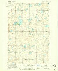
Medina serves as the central hub of this mid-century prairie landscape, situated along the vital Northern Pacific railroad corridor. The town layout is clearly defined, showing the infrastructure supporting a rural agricultural economy in Stutsman County. Outside the town limits, the landscape is dotted with numerous small lakes and ponds, including the significant Chase Lake in the northwest. Evidence of earlier settlement patterns appears in the form of the Sch No 1 (Abandoned), suggesting a shift in local education as rural populations consolidated. To the southeast, St Marys Cem and several Gravel Pit operations indicate the community's established social and industrial anchors. The terrain is categorized by township names like Iosco, Peterson, and St Paul, which reflect the heritage of the surveyors and settlers who organized these plains into a productive grid.
Find a feature on this map
11 named features on this map. Tap any name to fly to it.
Don’t see what you’re looking for? This feature index may not catch every label — zoom into the map to look around manually.
Map Details
Editions of this 1954 Medina Map
This is the sole edition of this map. No revisions or reprints were ever made.
Other maps of this area

1952 · New Rockford
USGS Topo · 1:250,000

1953 · Jamestown
USGS Topo · 1:250,000

1953 · Cleveland SW
USGS Topo · 1:24,000

1954 · Cleveland NW
USGS Topo · 1:24,000

1955 · Crystal Springs
USGS Topo · 1:24,000

1955 · Medina SW
USGS Topo · 1:24,000

1955 · Medina SE
USGS Topo · 1:24,000

1956 · New Rockford
USGS Topo · 1:250,000

1956 · Jamestown
USGS Topo · 1:250,000
1958 · Goldwin SW
USGS Topo · 1:24,000