
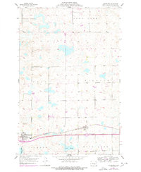
1953 Map of Cleveland
USGS Topo · Published 1955About this map
The Northern Pacific railroad corridor serves as the primary axis for development across this Stutsman County landscape, linking the small agricultural centers of Cleveland and Windsor. This mid-century survey reveals a highly organized township system, where the rural sections of Weld and Windsor townships are dotted with essential community fixtures like School No 6 and School No 3. These small schoolhouses and the St Pauline Cem provide significant touchpoints for genealogists researching the families who settled this prairie region.
Find a feature on this map
17 named features on this map. Tap any name to fly to it.
Don’t see what you’re looking for? This feature index may not catch every label — zoom into the map to look around manually.
Map Details
Editions of this 1953 Cleveland Map
2 editions found
Other maps of this area

1896 · Jamestown
USGS Topo · 1:125,000

1900 · Pingree
USGS Topo · 1:125,000

1900 · Pingree
USGS Topo · 1:62,500

1951 · Eldridge NW
USGS Topo · 1:24,000

1952 · Pingree SW
USGS Topo · 1:24,000

1952 · Eldridge SW
USGS Topo · 1:24,000

1952 · New Rockford
USGS Topo · 1:250,000

1953 · Jamestown
USGS Topo · 1:250,000

1953 · Cleveland SE
USGS Topo · 1:24,000

1953 · Cleveland SW
USGS Topo · 1:24,000