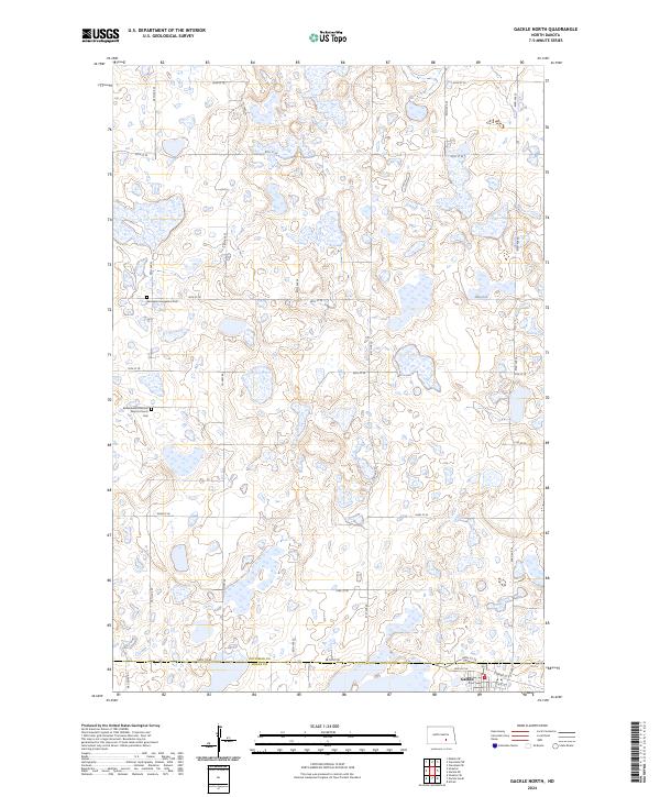
2024 Map of Gackle North
USGS Topo · Published 2024About this map
Gackle sits along the southern edge of this landscape, marking the transition from the prairie pothole region into the agricultural plains of the Missouri Coteau. This modern topographic survey reveals a terrain defined by countless small wetlands and seasonal basins scattered across the sections of t137n r68w and t137n r67w. Cultural landmarks such as the Germania Evangelical Cem and the Bloomenfeld German Baptist Church Cem preserve the heritage of early German-Russian settlement in the region. The map also delineates the administrative boundary of Stutsman Co Logan Co, showing how the local road network, including Co Hwy 68, follows the precise section lines of the Public Land Survey System to navigate the water-logged topography.
Find a feature on this map
24 named features on this map. Tap any name to fly to it.
Don’t see what you’re looking for? This feature index may not catch every label — zoom into the map to look around manually.
Map Details
Editions of this 2024 Gackle North Map
This is the sole edition of this map. No revisions or reprints were ever made.
Other maps of this area

1953 · Jamestown
USGS Topo · 1:250,000

1953 · Cleveland SE
USGS Topo · 1:24,000

1953 · Cleveland SW
USGS Topo · 1:24,000

1955 · Medina SE
USGS Topo · 1:24,000

1956 · Jamestown
USGS Topo · 1:250,000

1983 · Alfred
USGS Topo · 1:24,000

1983 · Streeter
USGS Topo · 1:24,000

1983 · Gackle North
USGS Topo · 1:24,000

1983 · Streeter SE
USGS Topo · 1:24,000
1983 · Gackle South
USGS Topo · 1:24,000