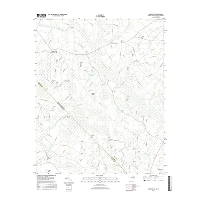
2016 Map of Gaddysville
USGS Topo · Published 2016About this map
Ashpole Swamp and the dense wetlands of Big Coupen Swamp dominate this landscape along the North Carolina South Carolina border. Small settlements like Gaddysville and Hammond Crossroads are linked by a network of rural roads that trace the higher ground between numerous bays and swamps, such as Butler Bay and Colson Bay. The map reveals a strong pattern of family and community history through its high concentration of local burial sites, including Pleasant Grove Cem, Mitchell Cem, and Worley Cem. Former industrial sites like Horns Old Millpond and its associated Horns Millrace indicate how the local hydrology was once managed for milling. Spiritual life in the area is anchored by landmarks like the Mount Zion Baptist Church, positioned near the state line, and the Piney Grove Baptist Church to the south.
Find a feature on this map
131 named features on this map. Tap any name to fly to it.
Don’t see what you’re looking for? This feature index may not catch every label — zoom into the map to look around manually.
Map Details
Editions of this 2016 Gaddysville Map
This is the sole edition of this map. No revisions or reprints were ever made.
Other maps of this area

1943 · Pages Mill
USGS Topo · 1:62,500

1953 · Florence
USGS Topo · 1:250,000

1954 · Florence
USGS Topo · 1:250,000

1959 · Fork
USGS Topo · 1:24,000

1960 · Dillon East
USGS Topo · 1:24,000

1962 · Fair Bluff
USGS Topo · 1:24,000

1962 · Fairmont
USGS Topo · 1:24,000

1962 · Lake View
USGS Topo · 1:24,000

1962 · Gaddysville
USGS Topo · 1:24,000

1962 · Fair Bluff
USGS Topo · 1:62,500