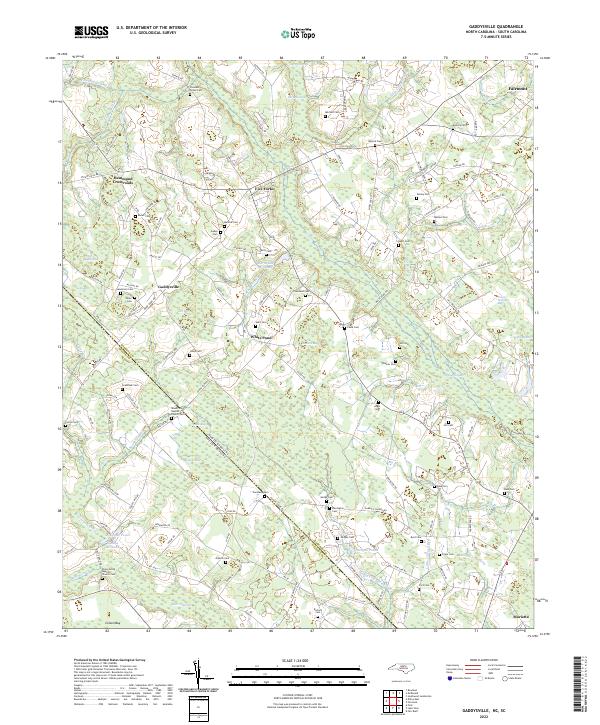
2022 Map of Gaddysville
USGS Topo · Published 2022About this map
Gaddysville and its surrounding rural landscapes are defined by a complex network of wetlands and drainage basins spanning the North Carolina South Carolina border. The terrain is characterized by numerous bays and swamps, including Butler Bay, Tupelo Bay, and the sprawling Ashpole Swamp to the east. These features shaped the early agricultural and industrial development of the region, as evidenced by Horns Old Millpond and Gaddys Millpond, which represent the historical reliance on water power for local milling operations.
Find a feature on this map
133 named features on this map. Tap any name to fly to it.
Don’t see what you’re looking for? This feature index may not catch every label — zoom into the map to look around manually.
Map Details
Editions of this 2022 Gaddysville Map
This is the sole edition of this map. No revisions or reprints were ever made.
Other maps of this area

1943 · Pages Mill
USGS Topo · 1:62,500

1953 · Florence
USGS Topo · 1:250,000

1954 · Florence
USGS Topo · 1:250,000

1959 · Fork
USGS Topo · 1:24,000

1960 · Dillon East
USGS Topo · 1:24,000

1962 · Fair Bluff
USGS Topo · 1:24,000

1962 · Fairmont
USGS Topo · 1:24,000

1962 · Lake View
USGS Topo · 1:24,000

1962 · Gaddysville
USGS Topo · 1:24,000

1962 · Fair Bluff
USGS Topo · 1:62,500