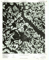
1976 Map of Gaddysville
USGS Topo · Published 1978About this map
Gaddysville and its surrounding agricultural landscape are captured in this orthophotomap, which utilizes 1976 aerial photography to document the North Carolina-South Carolina borderlands. The visual data reveals a distinct pattern of land use, where irregular patches of woodland interlace with rectangular cultivated fields, reflecting the localized drainage patterns of the coastal plain. Small rural hubs like Hammond Crossroads and Five Forks appear as clusters at the intersection of local routes, providing a clear view of the settlement footprint before modern suburban expansion. The photographic base allows researchers to identify specific homesteads and farm structures near White Pond, offering an unfiltered view of the rural infrastructure during the mid-1970s.
Find a feature on this map
4 named features on this map. Tap any name to fly to it.
Don’t see what you’re looking for? This feature index may not catch every label — zoom into the map to look around manually.
Map Details
Editions of this 1976 Gaddysville Map
This is the sole edition of this map. No revisions or reprints were ever made.
Other maps of this area

1943 · Pages Mill
USGS Topo · 1:62,500

1953 · Florence
USGS Topo · 1:250,000

1954 · Florence
USGS Topo · 1:250,000

1959 · Fork
USGS Topo · 1:24,000

1960 · Dillon East
USGS Topo · 1:24,000

1962 · Fair Bluff
USGS Topo · 1:24,000

1962 · Fairmont
USGS Topo · 1:24,000

1962 · Lake View
USGS Topo · 1:24,000

1962 · Gaddysville
USGS Topo · 1:24,000

1962 · Fair Bluff
USGS Topo · 1:62,500