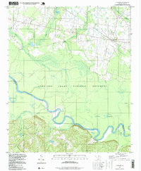
1994 Map of Gadsden
USGS Topo · Published 1999About this map
The Congaree Swamp National Monument dominates the southern half of this landscape, where the Congaree River carves a serpentine path through dense bottomland. The river's historical shifts are visible in features like the Old Dead River and various oxbow lakes, including Weston Lake and Braddy Lake. These water bodies, along with Butlers Gut and Sikes Gut, define a complex hydrologic network that supported local industries such as those at Bates Mill Creek.
Find a feature on this map
39 named features on this map. Tap any name to fly to it.
Don’t see what you’re looking for? This feature index may not catch every label — zoom into the map to look around manually.
Map Details
Editions of this 1994 Gadsden Map
This is the sole edition of this map. No revisions or reprints were ever made.
Other maps of this area

1943 · Eastover
USGS Topo · 1:62,500

1946 · Elloree
USGS Topo · 1:62,500

1946 · St. Matthews
USGS Topo · 1:62,500

1948 · Hopkins
USGS Topo · 1:62,500

1953 · Saylors Lake
USGS Topo · 1:24,000

1953 · Fort Jackson South
USGS Topo · 1:24,000

1953 · Eastover
USGS Topo · 1:24,000
1953 · Congaree
USGS Topo · 1:24,000

1953 · Gadsden
USGS Topo · 1:24,000

1953 · Wateree
USGS Topo · 1:24,000