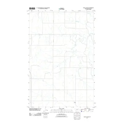
2011 Map of Gady Coulee
USGS Topo · Published 2011About this map
Sheep Creek meanders across the northern reaches of this McCone County landscape, defining the local hydrology within a network of drainage basins. The area is characterized by significant topographical depressions like Gady Coulee in the southeast, which mark the seasonal movement of water through the prairie. Modern infrastructure is represented by the transit corridor of MT Highway 201 and a grid of rural routes including Sunnyside Rd, Frontage Rd, and Good Rd. These roadways follow the sectional survey lines, illustrating the systematic land division common in the American West. The lack of concentrated settlements or named townsites suggests an area primarily dedicated to open-range grazing or large-scale agricultural operations typical of the high plains in the early twenty-first century.
Find a feature on this map
6 named features on this map. Tap any name to fly to it.
Don’t see what you’re looking for? This feature index may not catch every label — zoom into the map to look around manually.
Map Details
Editions of this 2011 Gady Coulee Map
This is the sole edition of this map. No revisions or reprints were ever made.
Other maps of this area

1912 · Chelsea
USGS Topo · 1:62,500

1916 · Wolf Point
USGS Topo · 1:62,500

1954 · Glendive
USGS Topo · 1:250,000

1954 · Wolf Point
USGS Topo · 1:250,000

1957 · Glendive
USGS Topo · 1:250,000

1958 · Wolf Point
USGS Topo · 1:250,000

1958 · Glendive
USGS Topo · 1:250,000

1972 · Chelsea SW
USGS Topo · 1:24,000

1972 · Macon
USGS Topo · 1:24,000
1972 · Nickwall
USGS Topo · 1:24,000