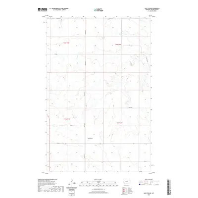
2020 Map of Gady Coulee
USGS Topo · Published 2020About this map
Gady Coulee and the drainage of Sheep Cr define this pocket of the Big Sky State, where the high plains are carved by winding seasonal watercourses. This 2020 survey of McCone County illustrates a landscape managed through a grid of section lines and gravel access roads, reflecting the large-scale ranching and dryland farming traditions of Eastern Montana. The map traces the path of Rte 201 as it cuts east-west through the terrain, connecting isolated properties and range land. Notable local identifiers like Shock, Ahren Loop, and Loges Rd provide essential touchpoints for researchers tracing family holdings or the specific geography of northern Big Sheep Creek country. The transition from the flat uplands near Sunnyside Rd to the intricate breaks of the coulees shows the relationship between topography and the placement of rural infrastructure.
Find a feature on this map
14 named features on this map. Tap any name to fly to it.
Don’t see what you’re looking for? This feature index may not catch every label — zoom into the map to look around manually.
Map Details
Editions of this 2020 Gady Coulee Map
This is the sole edition of this map. No revisions or reprints were ever made.
Other maps of this area

1912 · Chelsea
USGS Topo · 1:62,500

1916 · Wolf Point
USGS Topo · 1:62,500

1954 · Glendive
USGS Topo · 1:250,000

1954 · Wolf Point
USGS Topo · 1:250,000

1957 · Glendive
USGS Topo · 1:250,000

1958 · Wolf Point
USGS Topo · 1:250,000

1958 · Glendive
USGS Topo · 1:250,000

1972 · Chelsea SW
USGS Topo · 1:24,000

1972 · Macon
USGS Topo · 1:24,000
1972 · Nickwall
USGS Topo · 1:24,000