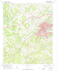
1971 Map of Gaffney
USGS Topo · Published 1974About this map
The town of Gaffney serves as a dense hub of civic and religious life in South Carolina's Upstate during the early 1970s. The map reveals a robust concentration of institutions near the town center, including the Limestone College campus, the County Memorial Hospital, and the historic Courthouse. To the east, East Gaffney sits near the shores of Whelchel Lake, while the industrial and transport backbone of the region is traced by the Southern railroad lines that bisect the landscape.
Find a feature on this map
63 named features on this map. Tap any name to fly to it.
Don’t see what you’re looking for? This feature index may not catch every label — zoom into the map to look around manually.
Map Details
Editions of this 1971 Gaffney Map
2 editions found
Other maps of this area

1909 · Gaffney
USGS Topo · 1:62,500

1941 · Spartanburg
USGS Topo · 1:250,000

1947 · Spartanburg
USGS Topo · 1:62,500

1949 · Spartanburg
USGS Topo · 1:62,500

1953 · Spartanburg
USGS Topo · 1:250,000

1953 · Charlotte
USGS Topo · 1:250,000

1954 · Charlotte
USGS Topo · 1:250,000

1959 · Cowpens
USGS Topo · 1:62,500

1960 · Charlotte
USGS Topo · 1:250,000

1960 · Spartanburg
USGS Topo · 1:250,000